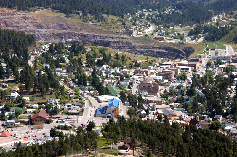
| Lead, South Dakota - from Wikipedia
Lead (LEED) is a city in Lawrence County, South Dakota,
United States. The population was 3,124 at the 2010 census. Lead is located
in western South Dakota, in the Black Hills near the Wyoming state line.
History
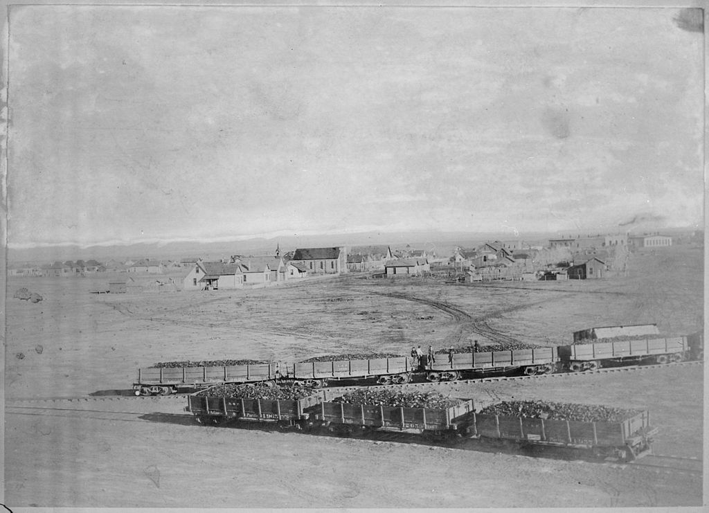
The city was officially founded on July 10, 1876, after
the discovery of gold. The city was named for the leads or lodes of the
deposits of valuable ores. It is the site of the Homestake Mine, the largest,
deepest (8,240 feet [2,510 m]) and most productive gold mine in the Western
Hemisphere before closing in January 2002. By 1910, Lead had a population
of 8,382, making it the second largest town in South Dakota.
Lead was originally founded as a company town by the Homestake
Mining Company, which ran the nearby Homestake Mine. Phoebe Hearst, wife
of George Hearst, one of the principals, was instrumental in making Lead
more livable. She established the Hearst Free Public Library in town, and
in 1900 the Hearst Free Kindergarten. Phoebe Hearst and Thomas Grier, the
Homestake Mine superintendent, worked together to create the Homestake
Opera House and Recreation Center for the benefit of miner workers and
their families. Phoebe Hearst donated regularly to Lead's churches, and
provided college scholarships to the children of mine and mill workers.
In the early 1930s, due to fear of cave-ins of the miles
of tunnels under Lead's Homestake Mine, many of the towns buildings located
in the bottom of a canyon were moved further uphill to safer locations.
Lead and the Homestake Mine have been selected as the
site of the Deep Underground Science and Engineering Laboratory, a proposed
NSF facility for low-background experiments on neutrinos, dark matter,
and other nuclear physics topics, as well as biology and mine engineering
studies.
In 1974, most of Lead was added to the National Register
of Historic Places under the name of the "Lead Historic District". Over
four hundred buildings and 580 acres (230 ha) were included in the historic
district, which has boundaries roughly equivalent to the city limits.
|
Custer, South Dakota - from Wikipedia

1876 |
Custer is a city in Custer County, South Dakota, United States.
The population was 1987 at the 2010 census. It is the county seat of Custer
County.
History
Custer is generally considered to be the oldest town established
by European Americans in the Black Hills of South Dakota and Wyoming. Gold
was found there during the 1874 Black Hills Expedition, conducted by the
7th Cavalry led by Lt. Colonel George Armstrong Custer, a discovery which
initiated the Black Hills Gold Rush.
For thousands of years, the Black Hills had been part
of the territory of varying tribes of indigenous peoples. They were within
historical territory of the Oglala Sioux at the time of United States encounter,
and within the Great Sioux Reservation established by the US Treaty of
Fort Laramie (1868). Having established dominance in the area by the eighteenth
century, the Oglala Sioux had long considered the Black Hills as sacred
land.
After increasing encroachment by European Americans and
violent confrontations, the U.S. government forced the Sioux to cede much
of the Black Hills in 1877, and opened the land for individual purchase
and settlement. In 1875 trespassing gold-boomers named their settlement
Stonewall (after the Confederate general, Stonewall Jackson), but it was
renamed for Custer. Almost abandoned in 1876 after word of the much larger
gold strikes in Deadwood Gulch spread, Custer later became an established
city.
Custer has had a smaller population and been less wealthy
than the Northern Hills cities of Deadwood and Lead. In addition to gold,
Custer and other cities based their economies on the extraction of industrial
minerals, which are still important to the regional economy. Custer claims
to have the widest Main Street in the United States. The city made the
street wide enough in the nineteenth century for a team of oxen pulling
a wagon to turn completely around.
Custer annually observes a "Gold Discovery Days" celebration
and festivities over the last full weekend of July. This heritage tourism
event celebrates the discovery of gold by the Custer expedition in nearby
French Creek and the subsequent founding of the town.
|
Fort Defiance, AZ from Wikipedia
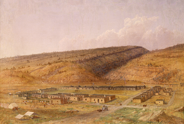
1873 |
Fort Defiance is a census-designated place (CDP) in Apache
County, Arizona, United States. The population was 3,624 at the 2010 census.
History
The land on which Fort Defiance was eventually established
was first noted by the U.S. military when Colonel John Washington stopped
there on his return journey from an expedition to Canyon de Chelly. Fort
Defiance was established on September 18, 1851, by Col. Edwin V. Sumner
to create a military presence in Diné bikéyah (Navajo territory).
Sumner broke up the fort at Santa Fe for this purpose, creating the first
military post in what is now Arizona. He left Major Electus Backus in charge.
Fort Defiance was built on valuable grazing land that
the federal government then prohibited the Navajo from using. As a result,
the appropriately named fort experienced intense fighting, culminating
in two attacks, one in 1856 and another in 1860. The next year, at the
onset of the Civil War, the army abandoned Fort Defiance. Continued Navajo
raids in the area led Brigadier General James H. Carleton to send Kit Carson
to impose order. General Carleton's "solution" was brutal: thousands of
starving Navajo were forced on a Long Walk of 450 miles (720 km) and interned
near Fort Sumner, New Mexico, and much of their livestock was destroyed.
The Navajo Treaty of 1868 allowed those interned to return to a portion
of their land, and Fort Defiance was reestablished as an Indian agency
that year. In 1870, the first government school for the Navajo was established
there.
Today, the site of Fort Defiance is populated by buildings
dating from the 1930s to the present day used by various governmental agencies
including the Bureau of Indian Affairs, Indian Health Service, and the
Navajo Nation. The largest of these buildings was the Fort Defiance Indian
Hospital until 2002.
|
| Winslow, AZ from Wikidedia
Winslow is a city in Navajo County, Arizona, United
States. According to the 2010 census, the population of the city is 9,655.
History
Winslow was named for either Edward F. Winslow, president
of St. Louis and San Francisco Rail Road, which owned one half of the old
Atlantic and Pacific Railroad, or Tom Winslow, a prospector who lived in
the area.
The last Harvey House (La Posada Hotel) opened in 1930.
It was designed by Mary Colter. The hotel closed in 1957 and was used by
the Santa Fe Railway for offices. The railroad abandoned La Posada in 1994
and announced plans to tear it down. It was bought and restored by Allan
Affeldt and it currently serves as a hotel.
U.S. Route 66 was originally routed through the city.
A contract to build Interstate 40 as a bypass north of Winslow was awarded
at the end of 1977. I-40 replaced U.S. Route 66 in Arizona in its entirety.
Winslow achieved national fame in 1972 in the Eagles /
Jackson Browne song Take it Easy which has the line standing on a corner
in Winslow, Arizona."
Demographics
As of the census of 2000, there were 9,520 people, 2,754
households, and 1,991 families residing in the city. The population density
was 773.1 people per square mile (298.6/km²). There were 3,198 housing
units at an average density of 259.7 per square mile (100.3/km²).
The racial makeup of the city was 40.8% White, 5.18% Black or African American,
23.47% Native American, 1.03% Asian, 0.09% Pacific Islander, 13.49% from
other races, and 4.18% from two or more races. 28.84% of the population
were Hispanic or Latino of any race.
There were 2,754 households out of which 40.3% had children
under the age of 18 living with them, 50.2% were married couples living
together, 16.0% had a female householder with no husband present, and 27.7%
were non-families. 23.7% of all households were made up of individuals
and 10.1% had someone living alone who was 65 years of age or older. The
average household size was 2.86 and the average family size was 3.40.
In the city the population was spread out with 29.8% under
the age of 18, 11.0% from 18 to 24, 31.1% from 25 to 44, 18.1% from 45
to 64, and 10.0% who were 65 years of age or older. The median age was
31 years. For every 100 females there were 122.3 males. For every 100 females
age 18 and over, there were 134.6 males.
The median income for a household in the city was $29,741,
and the median income for a family was $35,825. Males had a median income
of $28,365 versus $20,698 for females. The per capita income for the city
was $12,340. About 17.5% of families and 20.9% of the population were below
the poverty line, including 26.9% of those under age 18 and 16.3% of those
age 65 or over.
1890 |
Main sights
The historic La Posada hotel has been beautifully restored.
It is home to acres of flower and vegetable gardens, the museum of painter
Tina Mion, and the Turquoise Room, a world class restaurant and martini
bar.
The nearby Meteor Crater, sometimes known as the Barringer
Crater and formerly as the Canyon Diablo crater, is a famous impact crater.
Standin' On The Corner Park is a park featuring murals
depicting the famous "Girl my Lord in a flatbed Ford". Winslow also has
an annual Standin' On The Corner street festival, traditionally held the
last week of September.
The Painted Desert and Petrified Forest are about 60 miles
east of Winslow. The Little Painted Desert is 18 miles north of Winslow.
Historical events
In the era of wood burning steam locomotives Winslow was
a center for adding water and fuel for the trains. All the passengers could
disembark and have a meal at La Posada since there would be enough time
during the required stop. During the 1920s many celebrities chose to come
west to Hollywood and when they stopped in Winslow a parade took place.
The local paper has pictures of these special events.
Winslow also had a round house for repairing of those
steam engines, which made Winslow an important stop for the rail road.
Sadly, when the station at Barstow CA was given the engineering responsibility
for the new diesel locomotives, Winslow began its slow decline. Company
brass moved out and other employees needed for such repairs did also.
In 1949 when the Shah of Iran came to America and toured
some sights, he chose to come to the Grand Canyon. His plane landed at
the Winslow airport and they took land transport to get to the canyon.
|
.
All articles submitted to the "Brimstone
Gazette" are the property of the author, used with their expressed permission.
The Brimstone Pistoleros are not
responsible for any accidents which may occur from use of loading
data, firearms information, or recommendations published on the Brimstone
Pistoleros web site. |
|