| Kansas City - from Wikipedia
Kansas City, or K.C., is the largest city, and second
largest metropolitan area, in the state of Missouri. It is the 37thlargest
city by population in the United States and the 23rdlargest by area. It
is the central city of the Kansas City metropolitan area, which straddles
the KansasMissouri border. It was founded in the 1830s as a Missouri River
port at its confluence with the Kansas River coming in from the west. Originally
called Kansas after the river, this became confusing upon the establishment
of Kansas Territory in 1854. The name Kansas City was assigned to distinguish
the two.
Sitting on Missouri's western border, with downtown near
the confluence of the Kansas and Missouri Rivers, the modern city encompasses
some 319.03 square miles (826.3 km2). Most of the city is located in Jackson
County, but portions of the city spill into Clay, Cass, and Platte counties.
It is one of Jackson County's two county seats (the other being Independence).
The 18th and Vine Neighborhood gave birth to the musical styles of Kansas
City jazz and blues. Kansas City is also known for its distinctive style
of barbecue. The area is infamous for the Border War that occurred during
the American Civil War, including the Battle of Westport and Bleeding Kansas.
Major suburbs include the Missouri cities of Independence and Lee's Summit
and the Kansas cities of Overland Park, Olathe, and Kansas City.
History
Kansas City, Missouri, was officially incorporated as
a town on June 1, 1850, and as a city on March 28, 1853. The territory
straddling the border between Missouri and Kansas at the confluence of
the Kansas and Missouri rivers was considered a good place to build settlements.
Exploration and settlement
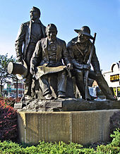 .. ..
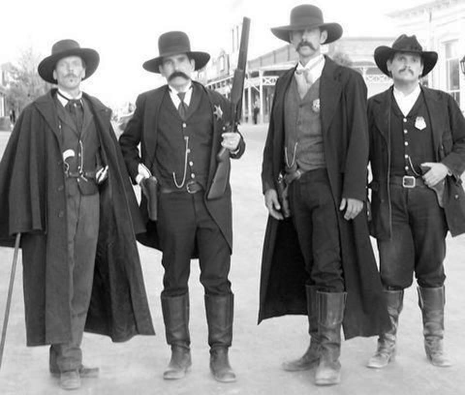
Kansas City Pioneer Square
monument in Westport
features Pony Express founder
Alexander Majors,
Westport/Kansas City founder
John Calvin McCoy and
Mountainman Jim Bridger who
owned Chouteau's Store. |
The first documented European visitor to Kansas City
was Étienne de Veniard, Sieur de Bourgmont, who was also the first
European to explore the lower Missouri River. Criticized for his response
to the Native American attack on Fort Détroit, he had deserted his
post as fort commander and was avoiding French authorities. Bourgmont lived
with a Native American wife in a village about 90 miles (140 km) east near
Brunswick, Missouri, where he illegally traded furs.
To clear his name, he wrote Exact Description of Louisiana,
of Its Harbors, Lands and Rivers, and Names of the Indian Tribes That Occupy
It, and the Commerce and Advantages to Be Derived Therefrom for the Establishment
of a Colony in 1713 followed in 1714 by The Route to Be Taken to Ascend
the Missouri River. In the documents, he describes the junction of the
"Grande Riv[ière] des Cansez" and Missouri River, making him the
first to adopt those names. French cartographer Guillaume Delisle used
the descriptions to make the area's first reasonably accurate map.
The Spanish took over the region in the Treaty of Paris
in 1763, but were not to play a major role other than taxing and licensing
Missouri River ship traffic. The French continued their fur trade under
Spanish license. The Chouteau family operated under Spanish license at
St. Louis in the lower Missouri Valley as early as 1765 and in 1821 the
Chouteaus reached Kansas City, where François Chouteau established
Chouteau's Landing.
After the 1804 Louisiana Purchase, Lewis and Clark visited
the confluence of the Kansas and Missouri rivers, noting it was a good
place to build a fort. In 1831, a group of Mormons from New York settled
in what would become the city. They built the first school within KC's
current boundaries, but were forced out by mob violence in 1833 and their
settlement remained vacant.
In 1833 John McCoy established West Port along the Santa
Fe Trail, 3-mile (4.8-kilometre) away from the river. |
In 1834 McCoy established Westport Landing on a bend in the
Missouri to serve as a landing point for West Port. Soon after, the Kansas
Town Company, a group of investors, began to settle the area, taking their
name from an English spelling of "Cansez." In 1850, the landing area was
incorporated as the Town of Kansas.
By that time, the Town of Kansas, Westport and nearby
Independence, had become critical points in America's westward expansion.
Three major trails the Santa Fe, California, and Oregon all passed
through Jackson County.
On February 22, 1853, the City of Kansas was created with
a newly elected mayor. It had an area of 0.70 square miles (1.8 km2) and
a population of 2,500. The boundary lines at that time extended from the
middle of the Missouri River south to what is now Ninth Street, and from
Bluff Street on the west to a point between Holmes Road and Charlotte Street
on the east.
American Civil War
The Kansas City area was rife with animosity just prior
to the U.S. Civil War. Kansas successfully petitioned the U.S. to enter
the Union as a free state that did not allow slavery under the new doctrine
of popular sovereignty. Missouri had many slaves. Slavery sympathizers
crossed into Kansas to sway the state towards allowing slavery, at first
by ballot box and then by bloodshed.
During the Civil War, the city and its immediate surroundings
were the focus of intense military activity. Although the First Battle
of Independence in August 1862 resulted in a Confederate victory, the Confederates
were unable to leverage their win in any significant fashion, as Kansas
City was occupied by Union troops and proved too heavily fortified to assault.
The Second Battle of Independence, part of Sterling Price's Missouri expedition
of 1864, also resulted in a Confederate triumph. Once again their victory
proved hollow, as Price was decisively defeated in the pivotal Battle of
Westport the next day, effectively ending Confederate efforts to occupy
the city.
General Thomas Ewing, in response to a successful raid
on nearby Lawrence, Kansas, led by William Quantrill, issued General Order
No. 11, forcing the eviction of residents in four western Missouri counties
including Jackson except those living in the city and nearby communities
and those whose allegiance to the Union was certified by Ewing.
Post-Civil War
After the Civil War, Kansas City grew rapidly. The selection
of the city over Leavenworth, Kansas, for the Hannibal & St. Joseph
Railroad bridge over the Missouri River brought about significant growth.
The population exploded after 1869, when the Hannibal Bridge, designed
by Octave Chanute, opened. The boom prompted a name change to Kansas City
in 1889 and the city limits to extend south and east. Westport became part
of Kansas City on December 2, 1897. In 1900, Kansas City was the 22nd largest
city in the country, with a population of 163,752 residents.
Kansas City, guided by architect George Kessler, became
a forefront example of the City Beautiful movement, offering a network
of boulevards and parks.
The relocation of Union Station to its current location
in 1914 and the opening of the Liberty Memorial in 1923 provided two of
the city's most identifiable landmarks. Robert A. Long, president of the
Liberty Memorial Association, was a driving force in the funding for construction.
Long was a longtime resident and wealthy businessman. He built the R.A.
Long Building for the Long-Bell Lumber Company, his home, Corinthian Hall
(now the Kansas City Museum) and Longview Farm.
Further spurring Kansas City's growth was the opening
of the innovative Country Club Plaza development by J.C. Nichols in 1925,
as part of his Country Club District plan.
Pendergast era
At the start of the 20th century, political machines gained
clout in the city, with the one led by Tom Pendergast dominating the city
by 1925. Several important buildings and structures were built during this
time, including the Kansas City City Hall and the Jackson County Courthouse.
The machine fell in 1939 when Pendergast, riddled with health problems,
pled guilty to tax evasion after long federal investigations. His biographers
have summed up Pendergasts uniqueness:
Pendergast may bear comparison to various
big-city bosses, but his open alliance with hardened criminals, his cynical
subversion of the democratic process, his monarchistic style of living,
his increasingly insatiable gambling habit, his grasping for a business
empire, and his promotion of Kansas City as a wide-open town with every
kind of vice imaginable, combined with his professed compassion for the
poor and very real role as city builder, made him bigger than life, difficult
to characterize.
PostWorld War II
Kansas City's suburban development began with a streetcar
system in the early decades of the 20th century. The city's first suburbs
were in the neighborhoods of Pendleton Heights and Quality Hill. After
World War II, many relatively affluent residents left for suburbs in Johnson
County, Kansas, and eastern Jackson County, Missouri. Many also went north
of the Missouri River, where Kansas City had incorporated areas between
the 1940s and 1970s.
In 1950, African Americans represented 12.2% of Kansas
City's population. The sprawling characteristics of the city and its environs
today mainly took shape after 1960s race riots. The assassination of Martin
Luther King, Jr. was a catalyst for the 1968 Kansas City riot. At this
time, slums were forming in the inner city, and many who could afford to
do so, left for the suburbs and outer edges of the city. The post-World
War II idea of suburbs and the "American Dream" also contributed to the
sprawl of the area. The city's population continued to grow, but the inner
city declined. The city's most populous ethnic group, non-Hispanic whites,
declined from 89.5% in 1930 to 54.9% in 2010.
In 1940, the city had about 400,000 residents; by 2000,
the same area was home to only about 180,000. From 1940 to 1960, the city
more than doubled its physical size, while increasing its population by
only about 75,000. By 1970, the city covered approximately 316 square miles
(820 km2), more than five times its size in 1940.
The Hyatt Regency walkway collapse was a major disaster
that occurred on July 17, 1981, killing 114 people and injuring more than
200 others during a tea dance. At the time, it was the deadliest structural
collapse in US history.
Walt Disney in Kansas City
In 1911, Elias Disney moved his family from Marceline
to Kansas City. They lived in a new home with a garage built by Elias Disney,
which became the location for Walt's very first animation, at 3028 Bellefontaine.[13]
In 1919, Walt Disney returned from France where he had served as a Red
Cross Ambulance Driver in World War I. Walt started the first animation
company Laugh-O-Gram Studio in Kansas City. Later, the company went bankrupt,
Walt Disney moved to Hollywood, and started The Walt Disney Company on
October 16, 1923.
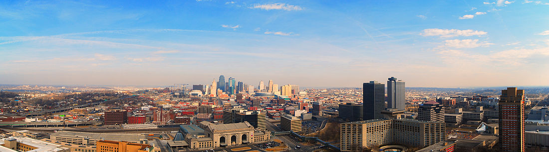
Geography
The city has a total area of 319.03 square miles
(826.28 km2), of which, 314.95 square miles (815.72 km2) is land and 4.08
square miles (10.57 km2) is water. Bluffs overlook the rivers and river
bottom areas. Kansas City proper is bowl-shaped and is surrounded to the
north and south by glacier-carved limestone and bedrock cliffs. Kansas
City is situated at the junction between the Dakota and Minnesota ice lobes
during the maximum late Independence glaciation of the Pleistocene epoch.
The Kansas and Missouri rivers cut wide valleys into the terrain when the
glaciers melted and drained. A partially filled spillway valley crosses
the central city. This valley is an eastward continuation of the Turkey
Creek Valley. It is the closest major city to the geographic center of
the contiguous United States, or "Lower 48".
Cityscape
|
| The first gold rush in the United States, Not in Claifornia -
from Wikipedia
Cabarrus /k??bær?s/ County is a county located
in the south-central part of the U.S. state of North Carolina. As of the
2010 census, the population was 178,011. The county seat is Concord, which
was incorporated in 1803.
Cabarrus County is included in the Charlotte-Concord-Gastonia,
NC-SC Metropolitan Statistical Area.
Among its significant historic sites is the Reed Gold
Mine, a National Historic Landmark. The first gold discovered in the United
States was found here in 1799, resulting in a gold rush in the early 1800s.
So much gold was mined that President Andrew Jackson established the US
Mint to control it.
This was an area of cotton cultivation in the antebellum
era and industrialization through cotton mills in the late 19th century.
Coleman Manufacturing Company, started in 1897, is believed to be the first
cotton mill in the nation to be built, owned and operated by African Americans.
It was owned by W.C. Coleman, John C. Dancy (collector of customs), and
partners primarily from Wilmington, North Carolina, although investors
also came from capitalists in the county.
History
The county was formed on December 29, 1792 from Mecklenburg
County. Located in the Piedmont, it was named after Stephen Cabarrus of
Chowan County, speaker of the North Carolina House of Commons.
Beginning about 1750, the county was settled mainly by
immigrants: Germans on the eastern side and Scotch-Irish in the western
area of the county. When it came time to choose a location for the county
seat and county government, each ethnic group wanted the county seat located
close to their populations and could not reach agreement on a site. Stephen
Cabarrus wrote to the citizens pleading with them to come together in peace
to choose a location for their county seat. A central area of the county
was chosen in 1796 and aptly named Concord, a derivative of two French
words "with" and "peace." Representative Paul Barringer introduced a bill
into the state legislature to incorporate Concord; it passed on December
17, 1806. The town of Concord was begun on land owned by Samuel Huie and
wife Jane Morrison Huie.
The first substantiated gold find in America was in 1799
by young Conrad Reed while playing in Little Meadow Creek, located on the
Reed farm in southeastern Cabarrus County. According to research, Conrad's
find was a gold chunk approximately the size of a shoe and weighing 17
pounds :11 His father John Reed took the nugget into Concord to a silversmith,
who informed Reed that the rock did not have any value. The elder Reed
returned home with it, holding it for three years until a trip in 1802
to Fayetteville, where he sold the "nugget" to a jeweler for $3.50. Over
time John Reed learned that the jeweler sold the large nugget for several
thousand dollars. Reed returned to Fayetteville insisting on more just
compensation. This discovery and news of the sale spurred the beginning
of gold mining in the area
John Reed, or Johannes Rieth as he is known in records
of the Staatsarchiv at Marburg, Germany, was one of thousands of Hessian
soldiers brought over by British troops to fight against rebellious colonists
in the American Revolution. Reed deserted, as did many other Hessians.
He traveled from Georgia to North Carolina, where he settled in an ethnic
German community sometime around 1787 and began farming.
Reed first developed placer mining on his property, then
underground mining, and became wealthy from the gold. His facility became
known as Reed's Gold Mine. Large amounts of gold were being discovered
at the Reed Gold Mine and in other mines in the United States; these mine
owners began to use their gold to create currency. In order for the government
to retain control of the production of currency and keep a stabilized economic
structure, President Andrew Jackson signed into legislation the authorization
to create branches of the US Mint. The Charlotte Mint was built to handle
the gold coming from the rich gold veins of North Carolina, including Reed's.
The Reed Gold Mine was designated a National Historic
Landmark, as it was the first gold mine in the country. Gold was mined
in North Carolina into the early 20th century. Today visitors at the site
can explore some of the mine's reconstructed tunnels.
Located in the Piedmont at the fall line, the county became
a site of industrialization with cotton mills constructed in the late 19th
century. Among the owners of the new mills in the area were men of the
rising black middle-class of Wilmington, North Carolina, such as W. C.
Coleman, John C. Dancy (appointed as collector of customs at the port),
and others. They organized Coleman Manufacturing Company in 1897, on a
site about two miles from Concord. They built and operated what is believed
to have been the first cotton mill in the nation to be owned by blacks.
They hoped to promote economic security for people of color. Richard B.
Fitzgerald was its first president. But the Wilmington Insurrection of
1898, with white attacks on blacks, their homes and businesses, destroyed
much of what the people had built there since the war. In 1900 Dancy was
among more than 2000 blacks who left the city permanently after the riot,
resulting in its becoming majority white. He moved to Washington, DC, appointed
as the federal Recorder of Deeds.
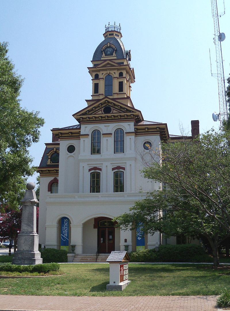
Old Courthouse
| The old Cabarrus County Courthouse was finished
in 1876. Recognized as significant in the 20th century, it was listed on
the National Register of Historic Places in 1974. The Confederate soldiers
monument is located on the front lawn area.
|
|